 The details about location, permit and how to get there can be found
on the page about the
Coyote Buttes South, Info & 1.Tour
and on info pages linked from there so I will skip that here.
The details about location, permit and how to get there can be found
on the page about the
Coyote Buttes South, Info & 1.Tour
and on info pages linked from there so I will skip that here.Less than a year after my first hike into this wonderland of sandstone I went back to one of the most fascinating areas in Arizona - and my favorite. Who ever has been there will know why. This time I hiked with a young guy from Switzerland who had been several times in the Southwest, loves to hike but had never been in the Coyote Buttes near Page. We planned our hike for the day after his tour to the famous Wave (Info & Photos) in the Coyote Buttes North. |
 The evening before we had talked about the Cottonwood area which is the
most interesting part of the Coyote Buttes South. Both of us
had specific interest in some 'spots'. He wanted to get to Cottonwood
Spring and onto the plateau. I was seeking for new, less known parts -
an area I call Cottonwood East and also the Cottonwood Cove which I had
looked down into on my first tour from the west rim of the Cottonwood
Plateau.
The evening before we had talked about the Cottonwood area which is the
most interesting part of the Coyote Buttes South. Both of us
had specific interest in some 'spots'. He wanted to get to Cottonwood
Spring and onto the plateau. I was seeking for new, less known parts -
an area I call Cottonwood East and also the Cottonwood Cove which I had
looked down into on my first tour from the west rim of the Cottonwood
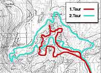
Plateau.Our considerations were easy to combine but the hike would take more than 6 hours - most of the time without any shade and about a third of it on sand. See the enlargeable map on the right and follow the line of this hiking route (2.Tour, green) counter clock wise, starting on the bottom right. |
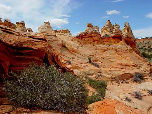
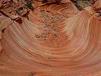
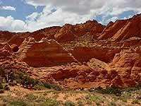
 Cottonwood East area (enlargeable) |
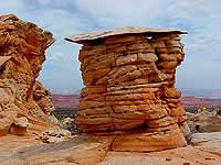
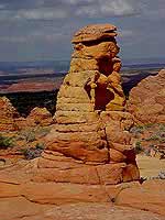
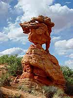
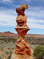 Victory Tower (enlargeable) |
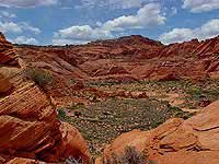
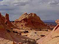
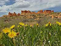 View towards Cottonwood Plateau (enlargeable) |
 Cottonwood Spring area (enlargeable) |
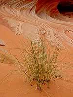 Cottonwood Spring area (enlargeable) |
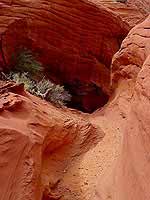
 View southwest into Cottonwood Cove (enlargeable) |
 'Frosted' Teepees (enlargeable) |
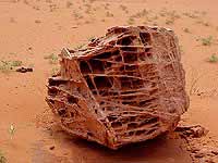 Fascinating stone (enlargeable) |
 Southern end Cottonwood Cove (enlargeable) |
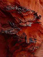 Iron or manganese (?) deposits at the very southern end of the Cottonwood Cove,... (enlargeable) |
 ...in the lower part of a steep and narrow natural rain water 'drainage'. (enlargeable) |
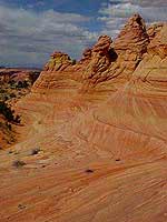 West side of the Cottonwood Plateau (enlargeable) |
 Brain Rock formations (enlargeable) |
 Cottonwood Plateau (enlargeable) |
 Cottonwood Plateau (enlargeable) |
| Datenschutzerklärung |